图书简介
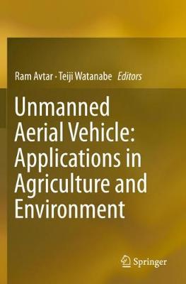
This book showcases how new and emerging technologies like Unmanned Aerial Vehicles (UAVs) are trying to provide solutions to unresolved socio-economic and environmental problems. Unmanned vehicles can be classified into five different types according to their operation. These five types are unmanned ground vehicles, unmanned aerial vehicles, unmanned surface vehicles (operating on the surface of the water), unmanned underwater vehicles, and unmanned spacecraft. Unmanned vehicles can be guided remotely or function as autonomous vehicles. The technology has a wide range of uses including agriculture, industry, transport, communication, surveillance and environment applications. UAVs are widely used in precision agriculture; from monitoring the crops to crop damage assessment. This book explains the different methods in which they are used, providing step-by-step image processing and sample data. It also discusses how smart UAVs will provide unique opportunities for manufacturers to utilise new technological trends to overcome the current challenges of UAV applications. The book will be of great interest to researchers engaged in forest carbon measurement, road patrolling, plantation monitoring, crop yield estimation, crop damage assessment, terrain modelling, fertilizer control, and pest control.
Chapter 1.?Introduction.- Chapter 2.Precision agriculture and Unmanned Aerial Vehicles (UAVs).- Chapter 3.Unmanned Aerial Vehicle (UAV)-based Hyperspectral imaging system for precision agriculture and forest management.- Chapter 4.Unmanned Aerial Vehicle (UAV) for fertilizer management in grassland of Hokkaido, Japan.- Chapter 5.Corn height estimation using UAV for yield prediction and crop monitoring.- Chapter 6.Supporting Oil palm replanting programs using UAV and GIS in Malaysia.- Chapter 7.Applications of UAVs in Plantation Health and Area Management in Malaysia.- Chapter 8.Unmanned Aerial Vehicle System (UAVS) Applications in Forestry and Plantation Operations: Experiences in Sabah and Sarawak, Malaysian Borneo.- Chapter 9.UAV-based SfM-MVS mapping cliff face in central crater of Miharayama, Izu Oshima, central Japan.- Chapter 10.Applications of UAV remote sensing to topographic and vegetation surveys.- Chapter 11.The Role of Infrared Thermal Imaging in Road Patrolling Using Unmanned Aerial Vehicles.- Chapter 12.Fusion and Enhancement Techniques for Processing of Multispectral Images.- Chapter 13.Application of Unmanned Aerial Vehicle (UAV) for Urban Green Space Mapping in Urbanizing Indian Cities.- Chapter 14.Responsibility and accountability in the governance of civilian UAV for crop insurance applications in India.
Trade Policy 买家须知
- 关于产品:
- ● 正版保障:本网站隶属于中国国际图书贸易集团公司,确保所有图书都是100%正版。
- ● 环保纸张:进口图书大多使用的都是环保轻型张,颜色偏黄,重量比较轻。
- ● 毛边版:即书翻页的地方,故意做成了参差不齐的样子,一般为精装版,更具收藏价值。
关于退换货:
- 由于预订产品的特殊性,采购订单正式发订后,买方不得无故取消全部或部分产品的订购。
- 由于进口图书的特殊性,发生以下情况的,请直接拒收货物,由快递返回:
- ● 外包装破损/发错货/少发货/图书外观破损/图书配件不全(例如:光盘等)
并请在工作日通过电话400-008-1110联系我们。
- 签收后,如发生以下情况,请在签收后的5个工作日内联系客服办理退换货:
- ● 缺页/错页/错印/脱线
关于发货时间:
- 一般情况下:
- ●【现货】 下单后48小时内由北京(库房)发出快递。
- ●【预订】【预售】下单后国外发货,到货时间预计5-8周左右,店铺默认中通快递,如需顺丰快递邮费到付。
- ● 需要开具发票的客户,发货时间可能在上述基础上再延后1-2个工作日(紧急发票需求,请联系010-68433105/3213);
- ● 如遇其他特殊原因,对发货时间有影响的,我们会第一时间在网站公告,敬请留意。
关于到货时间:
- 由于进口图书入境入库后,都是委托第三方快递发货,所以我们只能保证在规定时间内发出,但无法为您保证确切的到货时间。
- ● 主要城市一般2-4天
- ● 偏远地区一般4-7天
关于接听咨询电话的时间:
- 010-68433105/3213正常接听咨询电话的时间为:周一至周五上午8:30~下午5:00,周六、日及法定节假日休息,将无法接听来电,敬请谅解。
- 其它时间您也可以通过邮件联系我们:customer@readgo.cn,工作日会优先处理。
关于快递:
- ● 已付款订单:主要由中通、宅急送负责派送,订单进度查询请拨打010-68433105/3213。
本书暂无推荐
本书暂无推荐